El Niño is officially here: Here’s what that means for hurricane season
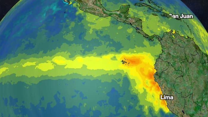
ORLANDO, Fla – It’s been the talk of the town and now, El Niño is officially here. The National Oceanic and Atmospheric Administration officially declared on Thursday an El Niño to be present.
El Niño is a natural climate phenomenon marked by warmer-than-average sea surface temperatures in the central and eastern Pacific Ocean near the equator, which occurs on average every 2-7 years. The impacts of El Niño extend beyond the Pacific.
There are varying intensities of El Niño and depending upon the season, a wide range of impacts.
For hurricane season, the Atlantic basin tends to see a less-active year in terms of number of storms. This is because during an El Niño, there is typically increased wind shear. Wind shear is detrimental to the development of tropical storms.
[TRENDING: Become a News 6 Insider]
On the flip side, the tropics are more active in the Eastern Pacific during an El Niño.
There is 84% chance that a moderate or even strong El Niño develops by winter.
While El Niño typically reduces the number of hurricanes in a given year, it is important to remember it only takes one. For example, 1992 was a well-below average hurricane season in terms of number of storms, but it also produced Category 5 Hurricane Andrew, which devastated South Florida.
For the 2023 hurricane season, while El Niño is the great suppressor, the Atlantic Basin including Caribbean Sea, Gulf of Mexico and Atlantic is already much above normal in the temperature department.
Typically, the influence from El Niño wins out when strong but the extremely warm Atlantic basin provides higher-than-normal uncertainty as to how the season will play out.
Get today’s headlines in minutes with Your Florida Daily:
Source: WKMG News 6 & ClickOrlando


