PM Update: Showery into tonight, then a break between storms Saturday
Listen 2 min Comment on this story Comment Gift Article Share
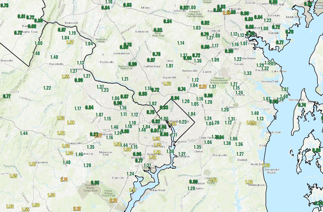
Radar courtesy MyRadar | © OpenStreetMap contributors We topped an inch of rain in one day for the first time this year. It went about as you might expect an all-day rain to go, but we do need it. Totals of 1.11 inches for D.C. and 1.07 inches at Dulles through 4 p.m. will rise a bit more this evening, but a majority of the rain from this event is done. It remains damp, and there may be some fog to deal with tonight.
Through Tonight: While the most widespread rain is winding down, drizzle and showers — some of which could be briefly heavy — will persist into the night. Some spots could get another half inch or so, with many seeing less than that. Fog may develop, given plentiful low-level moisture. Temperatures don’t move much, hanging out in the low and mid-50s in most spots.
Advertisement
View the current weather at The Washington Post.
Tomorrow (Saturday): Some patchy fog, a bit of drizzle or a shower may linger into the early morning. Clouds will be numerous through the day, although we could see partial sunshine for a time in the midday and afternoon. High temperatures will be right around 70. Winds will be from the east and southeast around 5 to 10 mph.
Sunday: We’ll have more rain, and we can still use it. It probably won’t be as consistent as today, but could come in a few waves that include heavy stuff for a time, possibly with some afternoon rumbles. Additional totals of about half an inch to an inch seem likely. Low pressure will pass right over the region, which should help it be a bit warmer than today. Highs will be mainly in the 60s to near 70. Winds will gust around 30 mph from the south.
Want our 5 a.m. forecast delivered to your email in-box? Subscribe here.
GiftOutline Gift Article
Source: The Washington Post


