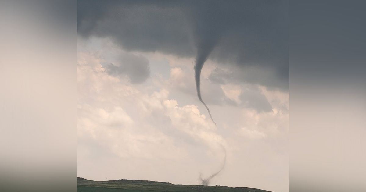
Multiple tornadoes reported in eastern Colorado amid severe weather outbreak
DENVER — A rare severe weather threat is looming over the Denver area and Eastern Plains Wednesday afternoon and evening.
The National Weather Service issued a severe thunderstorm warning for the Denver area and portions of Northern Colorado until 8 p.m.
“All weather hazards are on the docket today,” said NOAA forecaster Greg Heavener. "This could be a long duration severe threat today."
The highest potential for severe thunderstorms in the Denver area is from 4 p.m. to 7 p.m., according to Heavener.
The warning area includes threats of tornadoes and widespread hail the size of apples, according to the NWS. A tornado watch is in effect from Lochbuie to Fort Morgan to Sterling until 8 p.m.
Reports of multiple tornadoes came into the NWS during the outbreak. At 3:46 p.m., a confirmed tornado was located 14 miles northwest of Sterling in Logan County, moving north at 5 mph. And at least two tornadoes were reported near Akron around 4:30 p.m. There were no reports of damages or injuries.
NWS
"If the cap breaks mid-afternoon as it looks to, there will be widespread severe storms and all hazards are possible. We have been upgraded to enhanced hail threat by SPC, and a Tornado Watch is almost certain," a National Weather Service forecast discussion said.
A flood watch will be in effect for most of the plains south of the South Platte River, including the Palmer Divide, eastern Adams and Arapahoe counties, until 6 a.m. Thursday, according to the National Weather Service.
Street flooding is occurring in El Paso County. The Colorado Springs Fire Department tweeted that several streets in Research are shut down due to high water.
Research is shutdown.
AVOID THE AREA. Water is very high and several roads are shutdown/blocked. #cowx #csfd pic.twitter.com/HYhM9Bmmfm — CSFD PIO (@CSFDPIO) June 21, 2023
MORE | Hourly forecast | Radars | Traffic | Weather Page | 24/7 Weather Stream
Temperatures will cool a bit by Thursday and we'll see more afternoon thunderstorms. Highs will be in the upper 70s to low 80s.
It'll warm up and dry out Friday through the weekend. Expect highs to return to the 80s under a sunny sky each afternoon.
Storms return to Colorado Wednesday afternoon and evening
Source: Denver 7 Colorado News


