New England weather: More rain expected in Vermont, Boston area
Thursday is our driest day for a while and an unsettled weather pattern takes hold again overnight through early next week. A couple isolated showers will be around Thursday, but most locations avoid the rain during daylight in Massachusetts. Daily thunderstorm chances will lead to some flooding concerns and periodic damaging wind gusts with any stronger storms. The humidity is also here to stay through next week. During the afternoon, our highs reach the 80s, with inland valleys getting into the low 90s again.
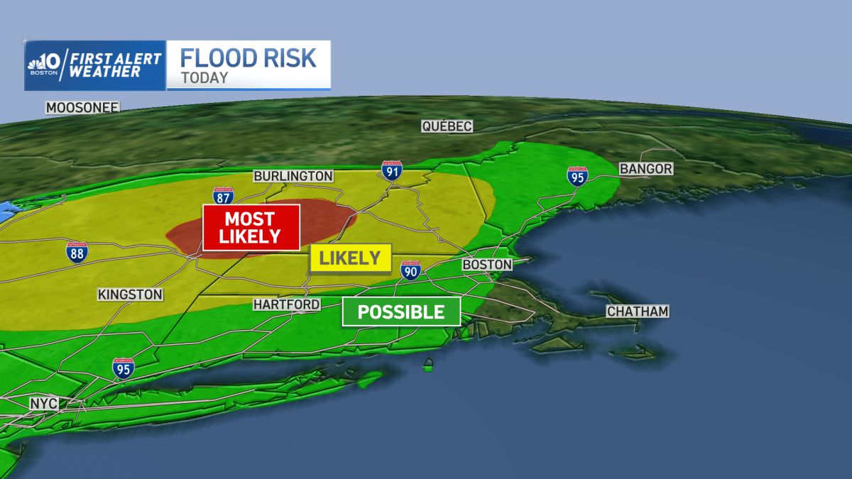
Vermont will see thunderstorms first as a line develops out across northern New York and heads east. These storms could produce a brief tornado west or around Lake Champlain, to damaging wind or small hail. The more likely threat is the extremely heavy rainfall from the storms. This will lead to some flash flood warnings and eventually more river flooding as the storms head through Burlington Thursday evening, and towards the mountains from 5 to 7 p.m. As the storms head south and east they fizzle a bit, but still bring some heavy rain to western and central Mass. and New Hampshire prior to midnight. Boston doesn’t see rain until after midnight.
Get Boston local news, weather forecasts, lifestyle and entertainment stories to your inbox. Sign up for NBC Boston’s newsletters.
Predawn storms will be around Connecticut, Rhode Island and eastern Massachusetts, with locally heavy rainfall and some lightning or thunder waking you up before that morning alarm goes off. The storms head towards Cape Cod after sunrise. However, more storms develop across Connecticut and Rhode Island, and may head east into Massachusetts for mid to late morning. As we get some breaks in the afternoon, temps warm to the low 80s and there may be some sun around. This will contribute to new storms after 2 p.m. and through the evening. Those also will bring flooding rainfall and some damaging wind gusts to Boston and much of southern New England again. This is why Friday is a First Alert day as it seems we see two rounds of storms, one in the morning, then afternoon and evening.
Another round of storms rolls through for Saturday morning in southeastern New England. There will be afternoon breaks for sun to boost temps into the 80s with a soupy airmass. But the pop up storms will be around through sunset.
Clouds, showers and cooler temps will be around on Sunday as we continue to see this unsettled pattern. The rain and storms linger for Monday and Tuesday at least. Midweek Wednesday into Thursday there is perhaps a lull in rain for a brief time. Then the end of the week and next weekend, we have storm chances again.
Source: NBC10 Boston


