PM Update: Smoke bringing some of world’s worst air to D.C. region
Listen 2 min Comment on this story Comment Gift Article Share
* Code Orange air quality alert through Tuesday, unhealthy for sensitive groups * We knew the smoke would be back at some point, but it’s disappointing to see nonetheless. An orange haze hovered over the area yet again today as raging wildfires in Canada sent us another present — this time from the west of the country. It’ll stick with us tonight and into tomorrow, hopefully dissipating during the day.
Through tonight: There could be a storm, especially west of Interstate 95. Most spots see nothing. Partly cloudy conditions prevail, with smoke still in our skies. Lows range from near 70 to the mid-70s.
View the current weather at The Washington Post.
Tomorrow (Tuesday): It’s a lot like today. Partly to mostly sunny skies should rule, with haze from Canadian wildfire smoke still hanging out. It should dissipate over time. Otherwise, a typical July day, with temperatures approaching 90 in most spots. Winds from the northwest blow around 10 mph.
Advertisement
See Jason Samenow’s forecast through the weekend. And if you haven’t already, join us on Facebook and follow us on Twitter and Instagram. For related traffic news, check out Gridlock.
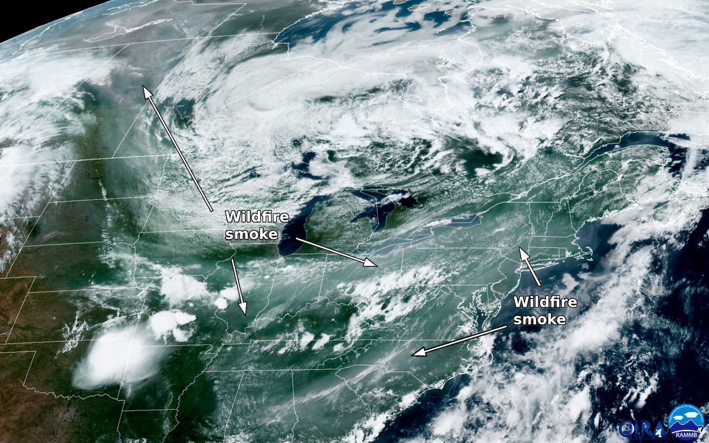
Return of the smoke: Bad air tied to wildfire smoke from Canada spilled over the Appalachians today and infiltrated much of the Northeast. Unlike major bouts in June that originated in Quebec and Ontario, this smoke made the long trek from Alberta and British Columbia.
With late-afternoon air quality deep into the Code Orange range and touching Code Red in spots, Washington has made the list of worst air quality for major cities on Earth. Again.
Want our 5 a.m. forecast delivered to your email inbox? Subscribe here.
Gift this article Gift Article
Source: The Washington Post


