Record-long heat wave in southern U.S. shows no sign of ending
Listen 5 min Comment on this story Comment Gift Article Share
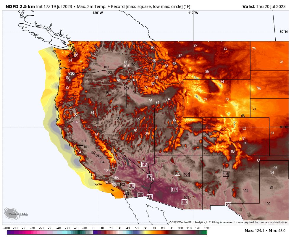
The brutal heat wave across the southern United States — remarkable for its size, intensity and duration — is still going strong, with little hope for significant relief. In fact, forecasts show the extreme heat expanding through this weekend, with approximately 80 million people experiencing a temperature or heat index above 105 degrees, according to the National Weather Service, and continuing well into next week.
Over the coming days, dozens of new record highs are forecast in the Southwest, while historically long streaks of extreme temperatures will grow. Phoenix’s record streak of 19 straight days reaching 110 degrees or higher could continue well into next week. The same is true both for El Paso’s streak of 33 consecutive days reaching 100 degrees or higher and Miami’s 38 straight days with heat indexes over 100.
Expect more nighttime heat records as well, such as the all-time record warm low temperature of 97 degrees set by Phoenix on Wednesday morning.
Advertisement
These five maps help to show what is still to come in this scorching heat wave for the record books.
The outlook is … HOT
Extreme heat, potentially including the extension of record hot streaks in Phoenix and El Paso, is likely to continue at least well into next week.
The National Weather Service’s Climate Prediction Center forecasts a high likelihood — a 60 to 90 percent chance — of above-normal temperatures across a large swath of the western half of the country and much of Florida in its six-to-10-day outlook issued Tuesday. The Weather Service describes “above normal” confidence in that forecast.
The eight-to-14-day outlook offers little relief, with the chance of above-normal temperatures at 60 percent or higher for much of the South. The main shift for that period, July 26 to Aug. 1, is a slightly lower chance of above-normal temperatures in Arizona and central-to-southern California, but a higher chance for the Southeast.
Huge heat dome is getting stronger
The heat dome that has been a mainstay over the southern United States and northern Mexico for weeks is only intensifying. Heat domes are sprawling areas of high pressure that trap heat beneath them. The higher the pressure, the hotter the air underneath. Therefore, the intensity of a heat dome is measured by the pressure it exerts from above, and models predict this could be the most intense heat dome on record over the southern United States.
Advertisement
Aside from its intensity, the heat dome also covers a huge area stretching from well into the eastern Pacific Ocean eastward across the southern United States, all the way into the Atlantic Ocean. Pressure levels “across an incredibly expansive area of the subtropics and southern U.S. will be higher than at any time in the 1979-2009 climate model record,” tweeted Greg Carbin, the Weather Service’s chief of forecast operations.
The heat dome scorching the southern United States is one of multiple heat domes occurring simultaneously around the world.
Dangerous heat indexes predicted to expand
High humidity has made the extreme heat especially dangerous. The heat index estimates how hot the air feels when factoring in the humidity. Heat indexes above 110 degrees have been common along the Gulf Coast and Southeast and have reached 120 degrees or higher in some locations. Dangerous combinations of heat and humidity are expected to continue at least well into next week, according to The Washington Post’s heat tracker, even expanding deeper into the south-central and southeast United States.
Advertisement
Around Florida, historically hot ocean waters in the mid-90s have contributed to the humidity as well. The heat index in Miami has reached 100 degrees or higher on a record 38 consecutive days.
“Take the heat seriously an avoid extended time outdoors. Temperatures and heat indices will reach levels that would pose a health risk, and be potentially deadly, to anyone without effective cooling and/or adequate hydration,” the Weather Service said.
The heat is even worse in the sun
The heat index most people are familiar with only factors in temperature and humidity and assumes you are in the shade. For those who work or exercise outside, the “wet bulb globe temperature” (WBGT) can be a more useful measure of how the heat affects your body.
Through early next week, WBGT levels are forecast to hover in the upper 80s in many parts of the southern states. At these levels, the American College of Sports Medicine advises canceling or at least limiting high-intensity activities.
Advertisement
The WBGT is measured and predicted assuming direct sunlight. It also takes into account wind speed, sun angle and cloud cover. Like the heat index, the WBGT is forecast to remain extremely high across much of the southern United States into next week.
Climate change is intensifying the heat
Climate change is making heat waves like the current one more likely, more frequent and more intense. Climate Central, a nonprofit science communication organization based in Princeton, N.J., attempts to capture the influence of climate change on extreme temperatures with its Climate Shift Index.
For predicted high temperatures on Friday, the 0-to-5 index registers at levels 3, 4 and 5 across much of the nation’s southern tier from Arizona to Florida. That means climate change is making the extreme heat at least three, four and five times as likely, according to the index. Climate Central describes Level 4 conditions as “extremely rare without climate change” and Level 5 as “an exceptional event driven by climate change.”
Gift this article Gift Article
Source: The Washington Post


