Invest 96L could become tropical depression as it churns across Atlantic
An area of low pressure spinning in the Atlantic Ocean, now dubbed Invest 96L, is still being monitored by the National Hurricane Center (NHC) for possible tropical development over the next several days.
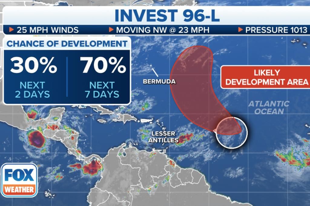
The NHC is giving Invest 96L a 30% chance of developing into a tropical system over the next two days, and a 70% chance of developing over the next week.
If Invest 96L continues to strengthen, it could become Tropical Depression Five or Tropical Storm Emily.
The term “invest” is a naming convention used by the NHC to identify a system forecasters are investigating for possible development into a tropical depression or tropical storm within the next week.
Where is Invest 96L?
The NHC said an area of disorganized cloudiness and showers associated with a tropical wave is located about 1,100 miles east of the Leeward Islands and is moving northwest.
Where is Invest 96L going?
Invest 96L is forecast to move west-northwestward to northwestward.
The NHC is giving Invest 96L a 30% chance of developing into a tropical system over the next two days, and a 70% chance of developing over the next week. Fox Weather
It is expected to turn north-northwestward to northward over the central subtropical Atlantic on Monday and Tuesday.
Over the weekend or early next week, the consensus of the various computer forecasts is that the system will break free of the densest part of a dust plume from the Sahara Desert and gather enough moisture to develop into at least a tropical depression, according to FOX Weather Hurricane Specialist Bryan Norcross.
“The disturbance is turning north through a break in the blocking high-pressure system that sprawls across the Atlantic in the summer – the so-called Bermuda High,” Norcross said Saturday.
“Next week, a big dip in the jet stream off the East Coast of the U.S. will scoop up the system and send it into the cold North Atlantic. There is no threat to land.”
Source: New York Post


