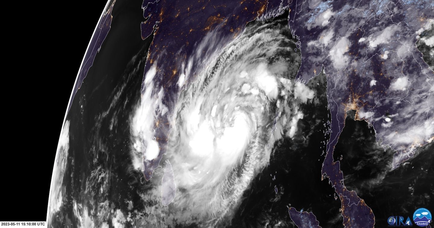
Cyclone Mocha forming in the Bay of Bengal, with a disastrous landfall likely
Listen 5 min Comment on this story Comment Gift Article Share
An area of disturbed weather has developed into Cyclonic Storm Mocha over the southern Bay of Bengal. Meteorologists have been anxiously watching the system, which could make landfall near the Myanmar-Bangladesh border region in the coming days. Are you on Telegram? Subscribe to our channel for the latest updates on Russia’s war in Ukraine. ArrowRight A sprawling system, Mocha’s outer cloud bands stretch almost the whole width of the large-mouthed bay in the northeastern Indian Ocean, or some 1,000 miles across. The cyclone was only in its early stages Thursday, with sustained winds around 60 mph and increasing, but it is expected to rapidly develop into a very severe cyclonic storm as it heads north and northeast toward landfall this weekend or early next week.
It should make landfall as a major tropical cyclone and perhaps a catastrophic one.
The current landfall zone appears likely to focus on northern Myanmar, also known as Burma, near the Bangladesh border. This is a region known for tropical cyclone mega-disasters — with extraordinary storm surge hitting highly populated areas — and one currently in the throes of war.
The playing field
Mocha was analyzed with sustained winds around 58 mph (50 knots) Thursday as it begins its main intensification period.
Sitting over waters that are running around or greater than 86 degrees (30 Celsius), which are more than plenty warm to support a high-end storm, Mocha was already producing waves up to 25 feet and growing.
“Mocha will track more northeastward … for the remainder of the forecast,” wrote the Joint Typhoon Warning Center (JTWC) in its Thursday update. They state landfall is likely to occur “just south of the Bangladesh-Myanmar border this weekend.”
Advertisement
Given minimal wind shear — disruptive gusts aloft that can hamper development — Mocha is expected to become what is locally referred to as a severe cyclonic storm over the next 12 to 24 hours, with additional and potentially rapid strengthening continuing thereafter.
Dangerous days ahead
Official forecasts from the India Meteorological Department and the Joint Typhoon Warning Center bring the storm to at least 100 to 115 mph sustained (85 to 100 knots) at landfall. Given the favorable environment of toasty waters, minimal disruptive shear and relatively slow movement, it’s very possible these solutions are on the conservative side.
As is often the case with tropical cyclones, Mocha’s track is more certain than its intensity. Since the storm is riding along the periphery of a powerful high-pressure dome, any shifts in landfall location are likely to be small. Factors regarding intensity are considerably trickier to nail down.
Advertisement
Some of the best weather modeling for tropical cyclones suggests that a much stronger storm than officially forecast is likely as it approaches shore. For instance, recent output from the HWRF hurricane model has shown pressures dipping close to 900 millibars at peak, which would easily equate to Category 4- or 5-equivalent intensity.
Even if Mocha were to peak over water and then weaken on its way to the coast, impacts such as deadly storm surge and battering waves, plus heavy flooding rains, will already be baked in.
People near the landfall zone and in low-lying areas across the region should be finalizing preparations or evacuations as necessary. More than 10,000 people have already left for shelter, according to Myanmar Now.
A tragic cyclone history plus ongoing war
The region is notorious when it comes to big storm surge, a rise in the level of the sea as a storm passes. A recent article from an expert sums it up well.
Advertisement
“The Bay of Bengal hosts only 4% of the total tropical cyclones globally,” wrote Roxy Mathew Koll, a climate scientist at the Indian Institute of Tropical Meteorology. “[B]ut more than 80% of the fatalities to cyclones are from this region.”
Primary causes for such a high toll are socioeconomic and because the northern bay in particular has high population density. But the water is also typically very warm, which is favorable for rapid intensification. Climate change is only adding fuel to the fire.
Doesn't look like it's running in real time yet, but EMC is running HAFS (the HAFS-A version) for #Mocha. Last night's forecast showed a strong Category 4 equivalent cyclone making landfall in Myanmar. Hope preparations are well underway there. pic.twitter.com/2TVyb0qZMI — Andy Hazelton (@AndyHazelton) May 11, 2023
Then there’s the simple geography of the bay.
The bay is wide in the south — where storms enter — and comes together in a point in the north, so that storm surge is exacerbated by the funneling of water. The slope from ocean to land is also quite small, with a large regular range of tides amid large river deltas. All factors promote large storm surges heading inland.
Advertisement
The bay has a long history of major storms. Amphan in 2020 was the latest of these super disasters. It came ashore in the northern bay after reaching Category 5 status. In 2017, a Category 1-equivalent Mora came ashore near the Bangladesh-Myanmar border, killing more than 150.
In May 2008, Cyclone Nargis became the second-deadliest tropical cyclone on record and the deadliest in Myanmar. It is believed to have killed more than 135,000, with a majority of deaths occurring in that country.
In this case, another factor is the ongoing civil war in Myanmar. With nearly 2 million internally displaced and another 1 million refugees, large populations may come under additional risk. The landfall region to the south of the Bangladesh border has historically been an active spot for fighting, and there are several giant camps for the displaced in the area.
GiftOutline Gift Article
Source: The Washington Post


